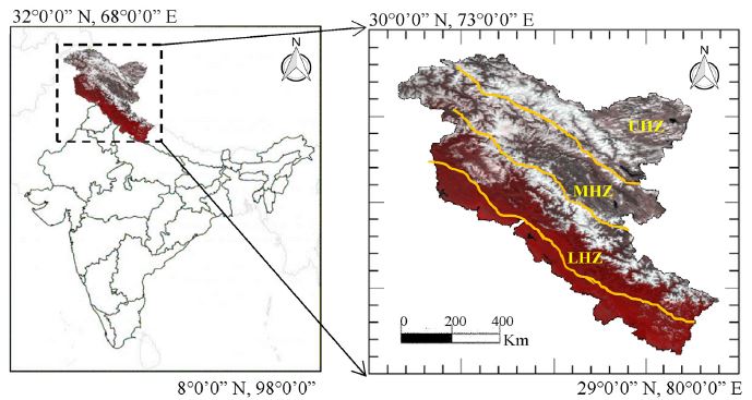
The Himalayas is an essential component of the cryosphere due to the large extent of snow or ice cover. The mapping and monitoring of snow cover variability over the Himalayas is the focus of many scientific studies due to the major source of water for Asian countries and equally important for climate change studies. This study describes the analysis of snow cover variability over North Indian Himalayas (NIH) covering Western Himalayas and Karakoram mountain ranges. The snow cover area (SCA) has been analyzed in three different climate zones such as the upper Himalayan zone (UHZ) (Ladakh and Karakoram range), middle Himalayan zone (MHZ) (Great Himalaya and Zanskar), and lower Himalayan zone (LHZ) (Pir Panjal and Shamshbari range) at various elevation levels as well as aspect levels during the past decade (2008–2019). The snow cover maps have been generated for NIH and its climate zones from Moderate Resolution Imaging Spectroradiometer (MODIS) data.

The global climate change is directly or indirectly impacting the regional climate of the Himalayas and thus, requires more attention to seasonal or inter-annual snow cover variations over the mountainous region. In the present work, the focus is on analyzing the seasonal snow cover variability at different elevations (LHZ, MHZ, and UHZ) and aspect levels (N, NE, SE, S, SW, W, NW) during the last decade (2008–2019). The NIH experienced global warming effects especially at lower and middle Himalayan zones which can be observed as shifting of snowmelt runoff and snow accumulation periods. The experimental outcomes suggest that shifting of this period are generally due to an increase in temperature over the Himalayan mountain range. The seasonal and annual trend analysis has shown that seasonal snow cover is varying across different elevations and geographical extent. The results computed in the present study have some limitations such as lack of incorporating precipitation data and in-situ or field observations. Therefore, the comparative analysis of different model outputs delivers important information regarding the impact of climate change over the snow cover area. This study also provides effective guidance in the prediction of natural hazard analysis and the protection of water resources.
For detailed Study:
Sood, V., Singh, S., Taloor, A.K., Prashar, S. and Kaur, R., 2020. Monitoring and mapping of snow cover variability using topographically derived NDSI model over north Indian Himalayas during the period 2008‒19. Applied Computing and Geosciences. https://doi.org/10.1016/j.acags.2020.100040